NEWS & UPDATES

This article has been archived
May 7, 2026
Connecting Basemaps to Spatial Manager

In August 2021 Land Information New Zealand (LINZ) released the Basemaps website. The site offers a centralised location to access aerial imagery across all of New Zealand.
With Spatial Manager, you can easily connect Basemaps to your CAD application, allowing you to display background aerial images in your drawing dynamically. To add this resource to Spatial Manager simply follow the instructions below.
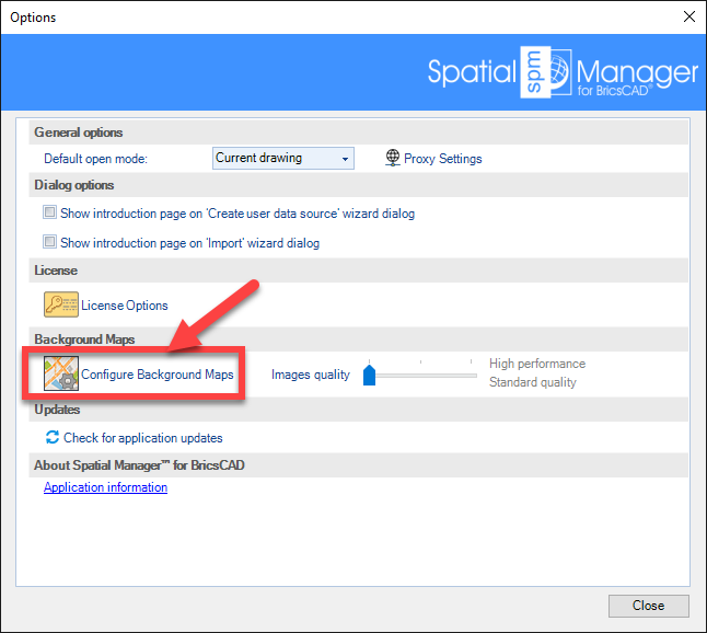
How to add Basemaps aerial maps to Spatial Manager
- Pick Options from the Spatial Manager Ribbon

- Select Configure Background Maps
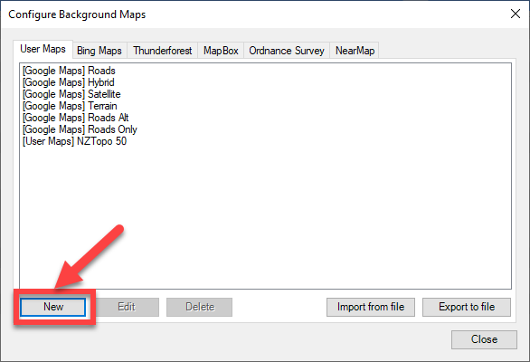
- Pick the New button
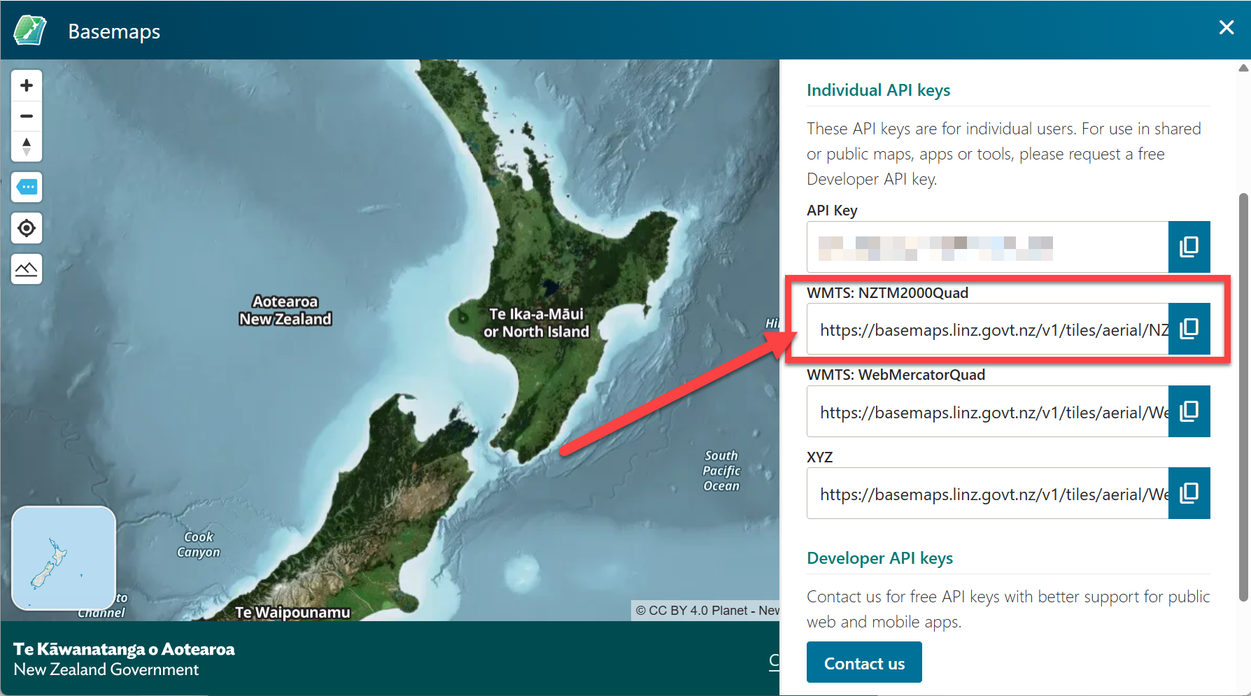
- From the Basemaps website copy the URL for WMTS:NZTM2000Quad
- In Spatial Manager: Select WMS as the type, paste in the copied URL, then pick the Save button
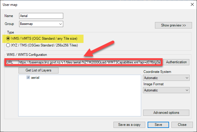
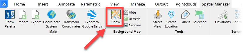
- You will now find that basemaps is included as an option when showing background maps
Ready to Transform Your CAD Workflow?
Contact us today to discover how CAD Concept's first-rate support and expert training can elevate your design process.